Fly Fishing Report for Trout and Bass Streams - May 16, 2025

Fly Fishing Report for Trout and Bass Streams - May 16, 2025

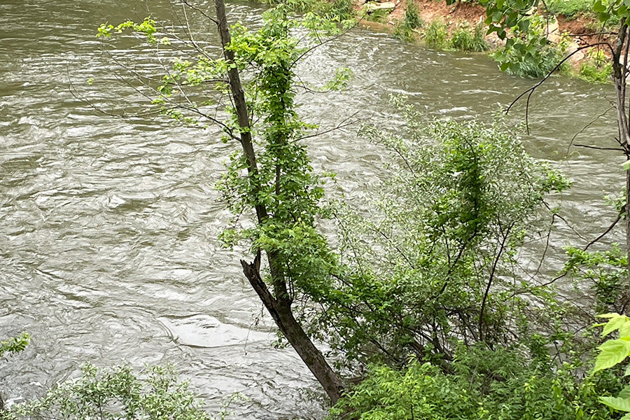
Big Stoney Creek (a stocked trout stream) runs right behind my fly shop in Edinburg. It has been up and down the last few days. It is running at full levels and starting to clear. (pictured above 5/16/25 at 3pm) I would recommend giving it another day or two before fishing it. Concentrate on areas upstream of Columbia Furnace. It was just stocked today so the rainbows should be spread out with the higher water levels. 

Passage Creek in Fort Valley (another stocked trout stream--just stocked 5/13/25) is currently discolored and running at very full levels. I would recommend giving this another few days to clear as well. 

The native brook trout streams in the Shenandoah National Park received heavy rain storms this week, causing major flooding and damage to trails and roads. I would recommend giving these streams a few days and then attempt to fish the streams from the Skyline Drive or upper reaches to get ahead of the high water. Check the SNP social media pages or CLICK here for updates on trail/road closures and the latest alerts. 

Their latest message on 5/16/25 2pm

An update from the Shenandoah National Park
Update for May 16, 2025:
Crews continue to evaluate trails for damage and high-water hazards. Some roads and trails will require regrading, and some will require material for repair. A reminder that not all trails have been assessed, so visitors could see high water crossings or trail damage. At this time, these trails and areas remain closed:
Limberlost Trail (mile 43)
Skyland Horse Trail (mile 49.4)
North Fork Moormans River Trail (boundary access from Sugar Hollow Road)
South Fork Moormans River Trail (boundary access from Sugar Hollow Road)
The Appalachian Connector Trail near Hawksbill Gap parking area (mile 45.5)
Dark Hollow Falls Trail (mile 50.7)
Whiteoak Canyon Trail (mile 42.6 on Skyline Drive and boundary access from Route 600)
Images: Ruts that measure about one-foot deep and a bit less than one-foot wide in the Old Rag parking lot.
Both the North Fork and South Fork of the Shenandoah River are too high and muddy for smallmouth bass fishing.  I expect it will take the North Fork at least 5 more days to start returning to normal levels.
Back to blog